


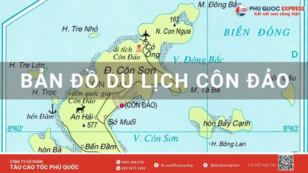
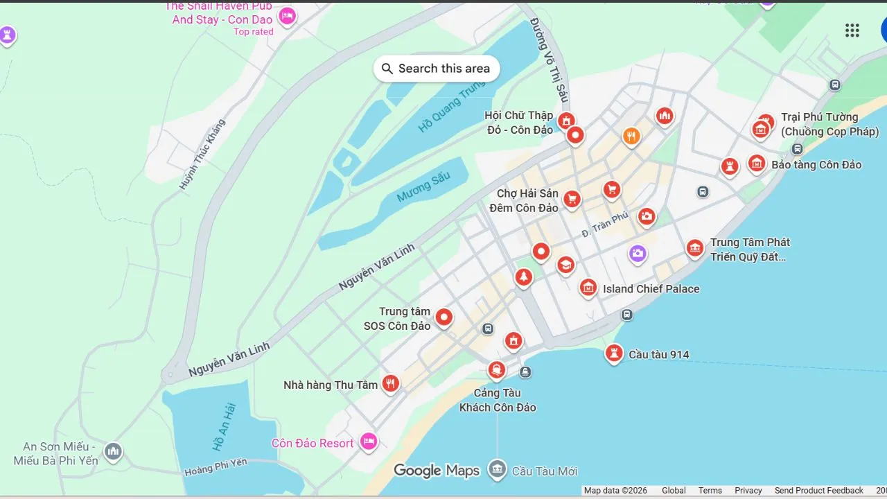
Côn Đảo Dao has 16 islands, but almost all tourism activities take place on the large island of Con Son. There is only one main road connecting the airport in the north with the port of Ben Dam in the southwest, passing through the center of the city. Therefore, just looking at the road is enough to see that the island is divided into two parts. Côn Đảo tourist map First, you know which direction to go first, how to collect points in the same session, and how to avoid driving the opposite direction.
This article, Phu Quoc Express split the entire destination into 4 clusters on the map, with distances, ticket prices, port locations, airports, and seasonal itinerary suggestions.
1. Where is Côn Đảo on the map of Vietnam?
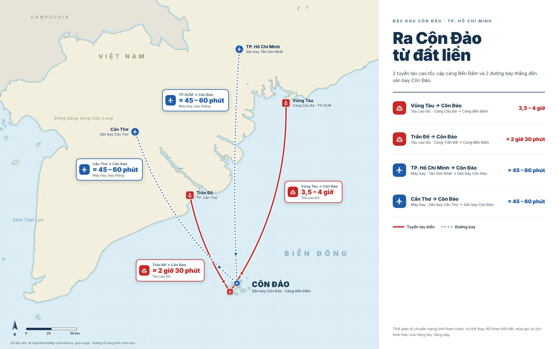
Côn Đảo Dao is located off the coast of the Southeast Sea. The islands are approximately 185 km from Vũng Tàu, approximately 230 km from the center of Ho Chi Minh City, and approximately 83 km from Can Cần Thơ. As of July 1, 2025, Côn Đảo district (formerly the province of Ba Ria-Vũng Tàu) became Côn Đảo Special Economic Zone in Ho Chi Minh City. The natural area of the special zone is approximately 76 km².
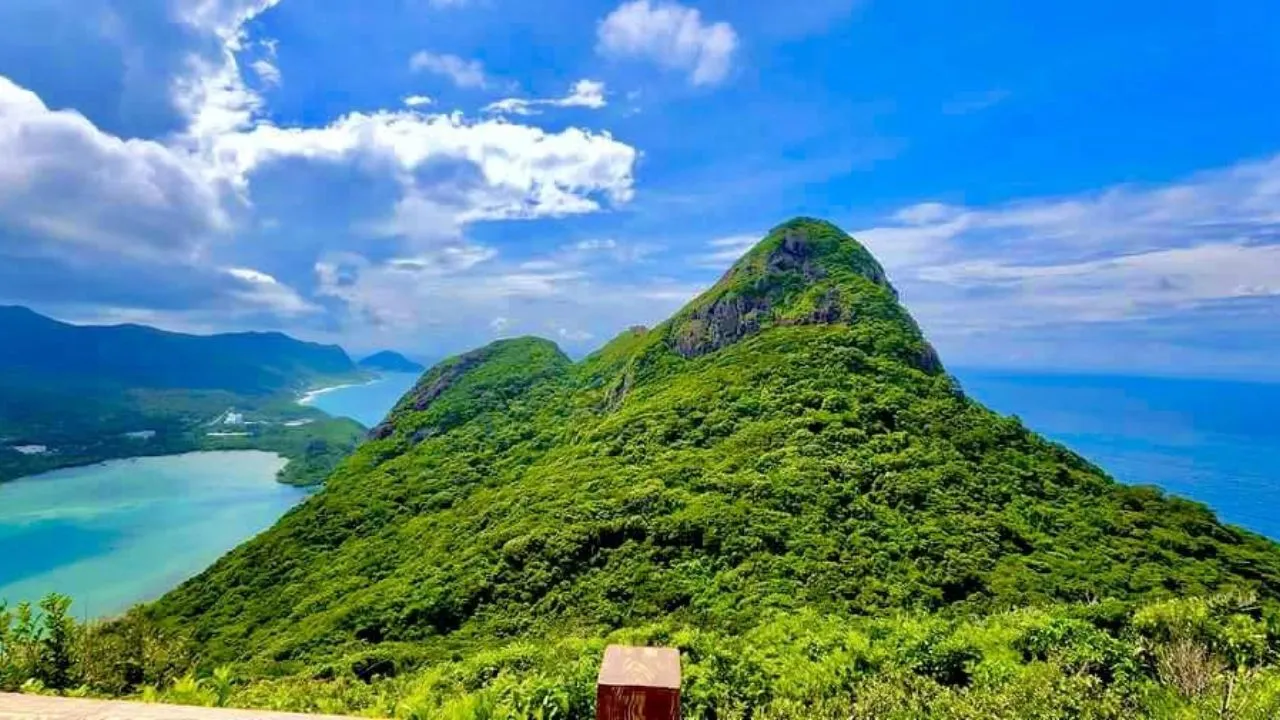
The archipelago consists of 16 islands. The largest is Con Son Island, which is approximately 51.5 km² in size and has a center area, an airport, a port, and most of the attractions. When viewed on a map, Con Son Island resembles a bear lying in the middle of the sea. The highest point is St. Cross Mountain (577 m), located on the southwestern side of the island.
| Starting point | Vehicle | Time reference |
|---|---|---|
| Ho Chi Minh City | Aircraft | About 1 hour |
| Vũng Tàu (Vũng Tàu Ward, Ho Chi Minh City) | Thăng Long – Phú Quốc Express high-speed train | About 3.5–4 hours |
| Trần Đề (Cần Thơ City, formerly Sóc Trăng) | Phu Quoc Express high-speed ferry | About 2 hours |
Book a train ticket to Côn Đảo: View the schedule of runs and book tickets for Vũng Tàu – Côn Đảo route, Trần Đề – Côn Đảo route here online.phuquocexpress.com.
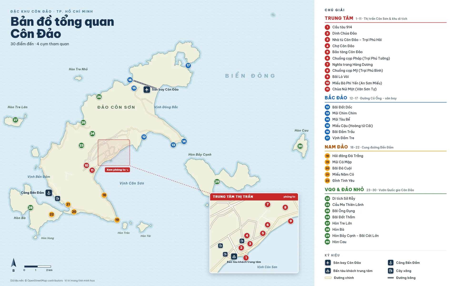
2. Overview map of Côn Đảo: 4 destination points
| Cluster on the map | Direction from the center | Highlights | Time should be spent |
|---|---|---|---|
| Center | Radius 0.5–2 km | Museums, Dong Dao Temple, detention centers, Hang Duong, 914 Pier, Ba Ba Temple, An Hai Beach | 1 day |
| Bắc Đảo | North East, along the way to the airport (~14 km) | Lime Kiln, Sloping Land, Cape Boat Basin, Trầu Pond, Tre Pond | Half a day |
| Nam Dao | Southwest, along the Ben Dam road (~12 km) | Mount One Pagoda, Cape of Sharks, Bai Nha beach, The peak of love, Bến Đầm harbor | Half a day (should be done in the afternoon) |
| National Park & small island | West (trekking) and offshore (cano) | Dong, Sở Rẫy, Hòn Bảy Cạnh, Hòn Cau, Hòn Tài, Hòn Tre | 1 day |
3. Types of maps that should be prepared for Côn Đảo
Paper map
Maps are useful when your phone runs out of battery or you lose signal on the mountain pass and in the forest. Paper maps are often available at hotels and service counters near airports and docks.
Google Maps and offline maps
Google Maps is useful for measuring distances and finding restaurants and hotels in the city center. On the Cỏ Ống pass, the Bến Đầm road and trekking routes, phone service may be intermittent. Please download offline maps of Côn Đảo before your trip.
3D/360-degree map of Côn Đảo
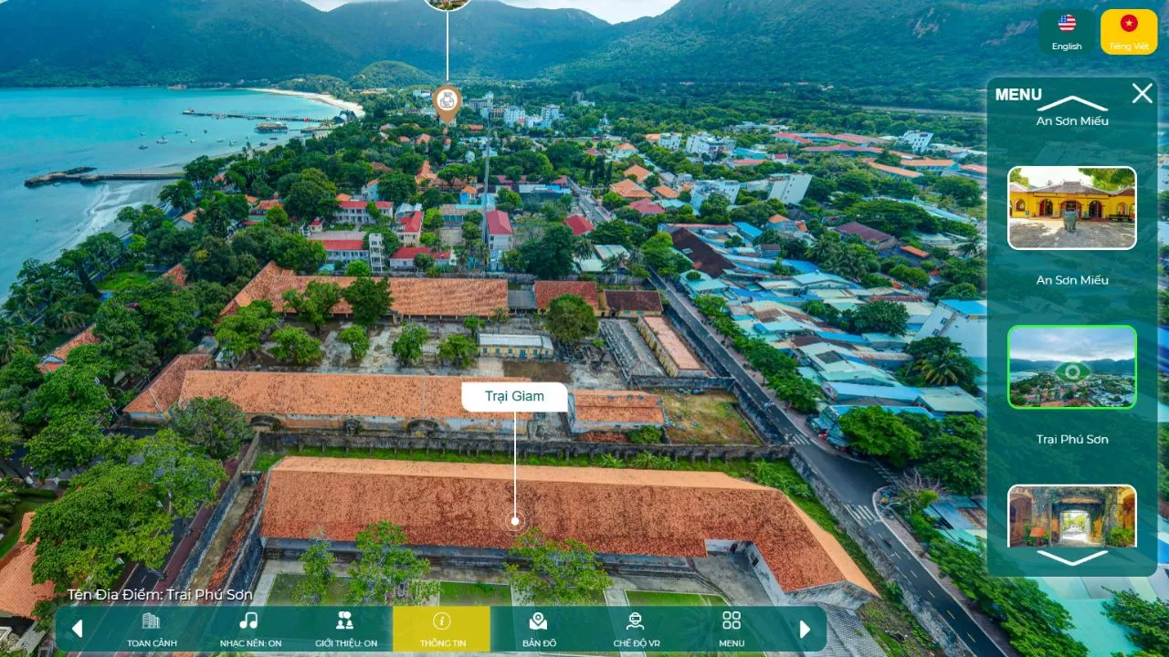
HCMC has included Con Côn Đảo in the 3D/360-degree smart tourism map at map3d.visithcmc.vn. On it, you can “see ahead” with 360-degree photos of Côn Đảo Dao Prison, Hàng Dương Cemetery, Museum, Phu Hai Camp, An Son Temple, Dam Trau Beach, Hon Cau, Hon Bảy Cạnh and Dam Tre Bay.
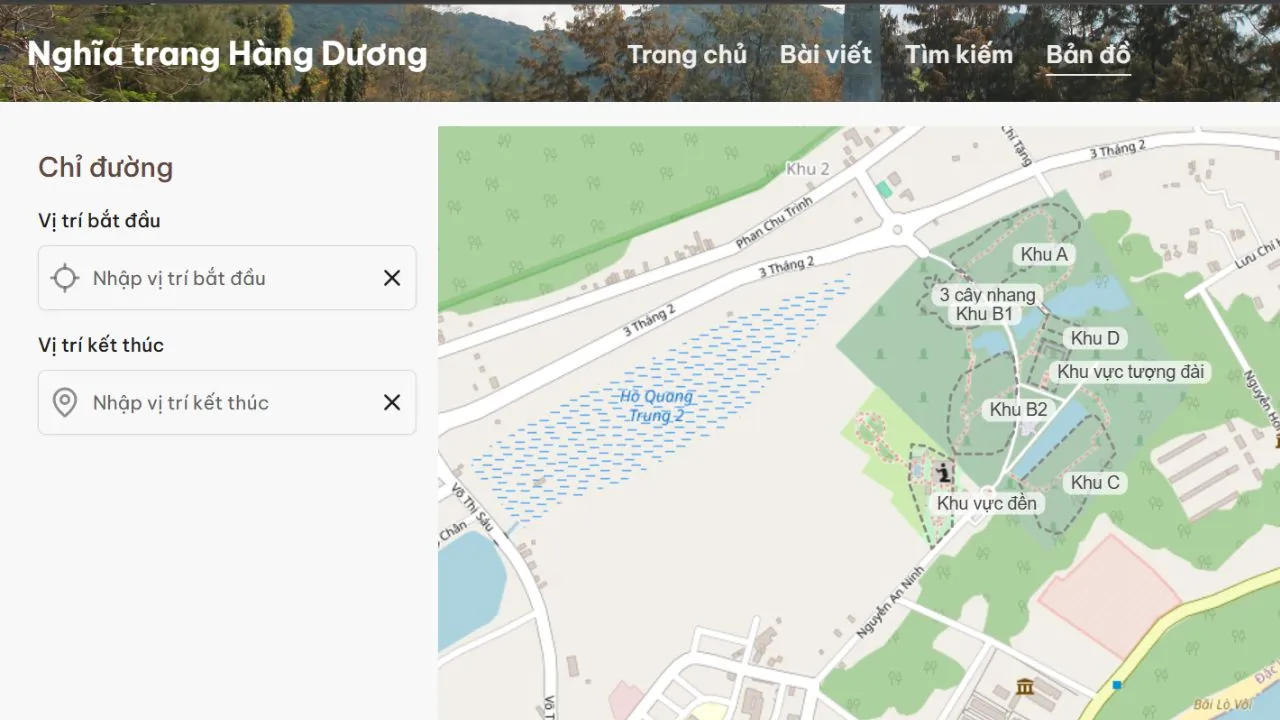
The number map of Hang Duong Cemetery
Starting in April 2026, Hàng Dương Cemetery will have a digital platform with a GPS map, which allows you to search for information about a grave remotely using a phone or computer. This tool is very useful if you are visiting a specific grave.
4. Traffic maps: airports, ports and highways
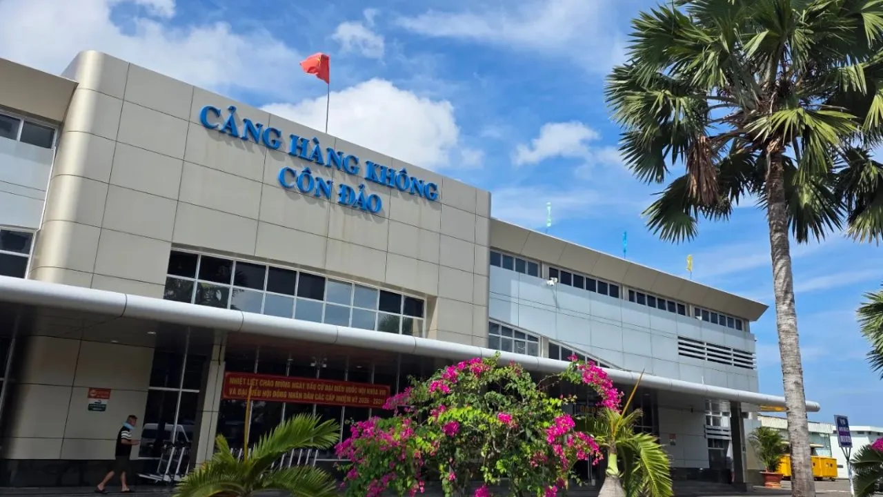
Côn Đảo Airport (Cỏ Ống)
The airport is located at the northeastern tip of Con Son Island, approximately 14 km from the center. It takes about 20–30 minutes by taxi or motorcycle to get to the center. The runway is located right next to Dam Trau Beach.
Ben Dam Port and the central passenger terminal
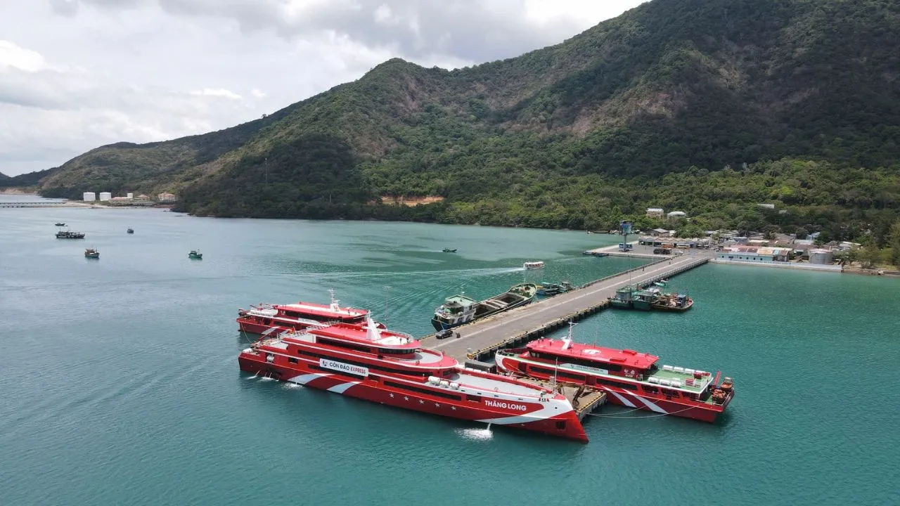
Ben Dam Port is located in a wind-protected bay between Con Son Island and Hon Ba Island, about 12 km southwest of the center. This is where high-speed boats from Vũng Tàu and Trần Đề De usually dock. In addition, in the central area on Ton Duc Thang Street there is the Côn Đảo Dao passenger ferry terminal. Please check your train ticket to know which station your trip will pick up and drop off passengers at.
North Island Axis: Nguyen Van Cu, Nguyen Chi Thanh, Co Co Ong
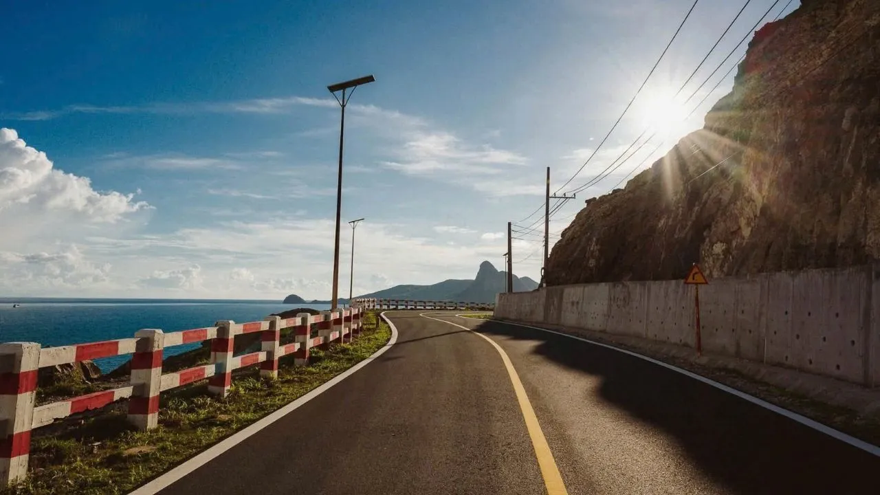
From the center, following Ton Duc Thang Road, Nguyen Van Cu and then Nguyen Chi Thanh, you pass through Cỏ Ống Pass to get to the airport. On one side of the road is the mountain, on the other side is the sea. There are the Lo Voi Beach, Dat Duc Doc Beach, Mui Tau Be Beach and the turnoff to Dam Trau.
South Island axis: Ben Dam Road
In the opposite direction, the Bến Đầm road follows the southwestern cliff, passing by Núi Một Temple, Shark's Point and Bãi Nhát before ending at Bến Đầm Harbor. This is the most beautiful sunset spot on the island.
Dong Ton Duc Thang Street and the central area
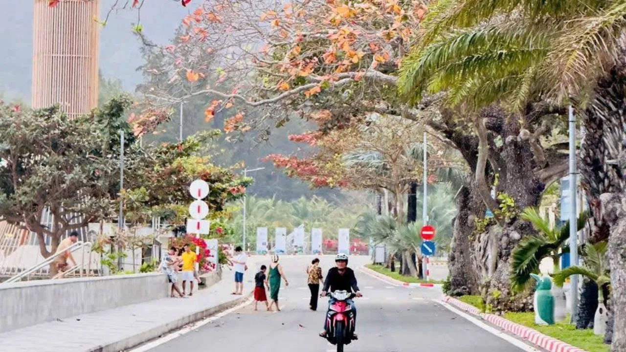
Ton Duc Thang is a road along the Côn Sơn bay, lined with ancient trees, where there is Pier 914, Dong Chau Temple, Truong Phu Hai Camp and many hotels and cafes. Nguyen Hue, Le Duan, Nguyen Van Linh and Pham Van Dong roads connect Côn Đảo Doan Market with the Museum, the detention camps and Hanh Duong Cemetery. On both sides of the road there are many old French-era houses.
Electric bus line 173 and other planned routes
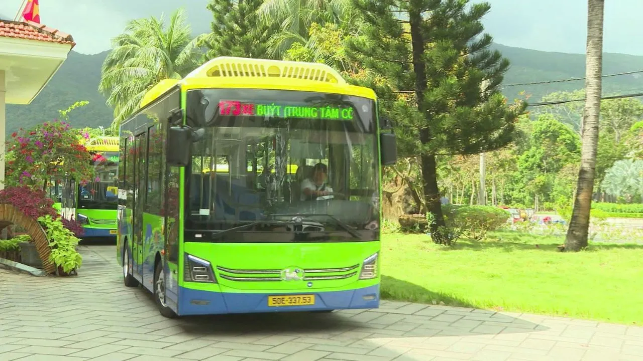
Bus line 173 (Con Côn Đảo Center – Cỏ Ống) runs from December 25, 2025, with a length of 17.1 km, with one trip taking about 30 minutes. Route: Con Côn Đảo Market, Pham Van Dong, Vo Thi Sau, Nguyen Hue, Ton Duc Thang, Nguyen Van Cu, Nguyen Chi Thanh, Cỏ Ống, then loop around Dam Trau Beach and then to the airport. The line has stops at the passenger ship pier and hotels on Ton Duc Thang Street. According to the plan, there will be an additional 5 lines 174 to 178, including line 175 connecting the center with Ben Dam port and line 178 connecting tourist attractions. Before the trip, you should check which line is running.
Renting a car and be mindful of refueling
| Vehicle | Reference price |
|---|---|
| Motorbike rental | 100,000–150,000 VND/day |
| Cab | About 12,000 VND/km |
| Electric vehicle | About 20,000 VND/km |
| 12–16-seat cars | From 1.5 million VND per day |
⚠️ Trên đảo rất ít cây xăng, và cây xăng đều nằm ở khu trung tâm. Dọc đèo Cỏ Ống và đường Bến Đầm không có chỗ đổ xăng, nên hãy đổ đầy bình trước khi rời trung tâm.
5. The Center Complex: monuments and spirituality
The points in this cluster are only 0.5–2 km apart; you can get there by motorcycle or on foot. You can cover the entire route in one day.
Con Dao Museum
The museum is located on Nguyen Huệ Street. It exhibits about 2,000 documents and artifacts about the nature and people of Côn Đảo and the 113 years of struggle within the prison system. Therefore, it is recommended to visit first to get a sense of the context before entering the prisons. Single ticket: VND 20,000.
Island Lord's Palace
The temple is located on Ton Duc Thang Street, with the main gate overlooking the 914 Bridge. Construction began in 1862 and was completed in 1876. The area covers approximately 1.86 hectares. This is the residence and workplace of 53 generations of island rulers over 113 years. Some of the monuments in the complex were temporarily closed for renovation, so ask at the ticket desk before you go.
Phu Hai Camp
Phu Hai is the largest and oldest prison in the Con Côn Đảo prison system. The entire system has 127 cells, 42 shackles, and 504 “tiger cage” isolation cells. This is part of the special national monument, Côn Đảo Prison.
French tiger cage (Phu Tuong Camp)
The prison was built in 1940, consisting of rows of bars with iron bars on the top to keep the guards from watching over the prisoners and torture the prisoners from above.
American Tiger Cage (Phu Binh Camp)
This area was built in 1971, a testament to the period when the US imperialists administered the prison.
Hang Duong Cemetery
The cemetery covers an area of nearly 20 hectares and has nearly 2,000 graves, divided into 4 areas: A, B, C, and D. Area A features the tomb of General Secretary Lê Hồng Phong and the patriotic leader Nguyễn An Ninh. Area B features the tomb of female hero Võ Thị Sáu, where visitors often visit at night. Therefore, please dress modestly when visiting.
Hang Keo Cemetery
Hàng Keo is an ancient cemetery, located near Hàng Dương and predating Hàng Dương. The majority of the remains here have been relocated to Area D of Hàng Dương Cemetery.
Pier 914
The pier, facing Dong Chau Island, is about 100 meters long and extends into Con Son Bay. This is a testament to the sacrifice of many prisoners who suffered. In the early morning, this place is a quiet spot to watch the sunrise right in the center.
Bà Phi Yến Temple (An Sơn Temple)
The temple is located in An Hai district, about 2 km from the center, near the foot of the Holy Cross Mountain. The temple was built in 1785 to worship Phi Yen, a figure revered by the people through many folk legends. The anniversary of Phi Yen takes place around October 16–18 of the lunar calendar every year and was inscribed as a national intangible cultural heritage in 2022.
An Hai Beach
The beach is about a 10-minute walk from the center, the water is clear and quite calm thanks to the mountains surrounding it. It is perfect for families with young children or older adults.
6. North Island Line (direction of Cỏ Ống airport)
This line is approximately 14–15 km long. You can stop on the way from the airport to the city center on the first day, or before the flight at the airport on the last day.
Lao Voi Beach
The beach is located near the center, with its back facing the Lo Voi mountain and facing the bay. This is the first stop on the way to Bacdao.
Slope Land
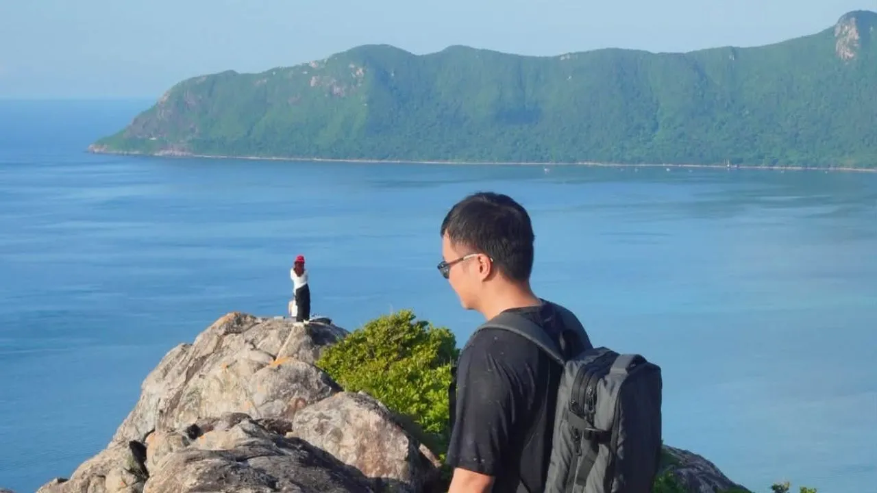
The beach is located in the middle of the route, with plenty of shade and long stretches of sand. The Six Senses Côn Đảo resort is located on this beach.
Nose of the Ship
The cape located on Cỏ Ống Pass is a series of standing rocks arranged in a spiral shape hugging the sea. This is considered the most beautiful place to watch the sunrise in Côn Đảo. The rocks are smooth and steep, so be careful when taking photos.
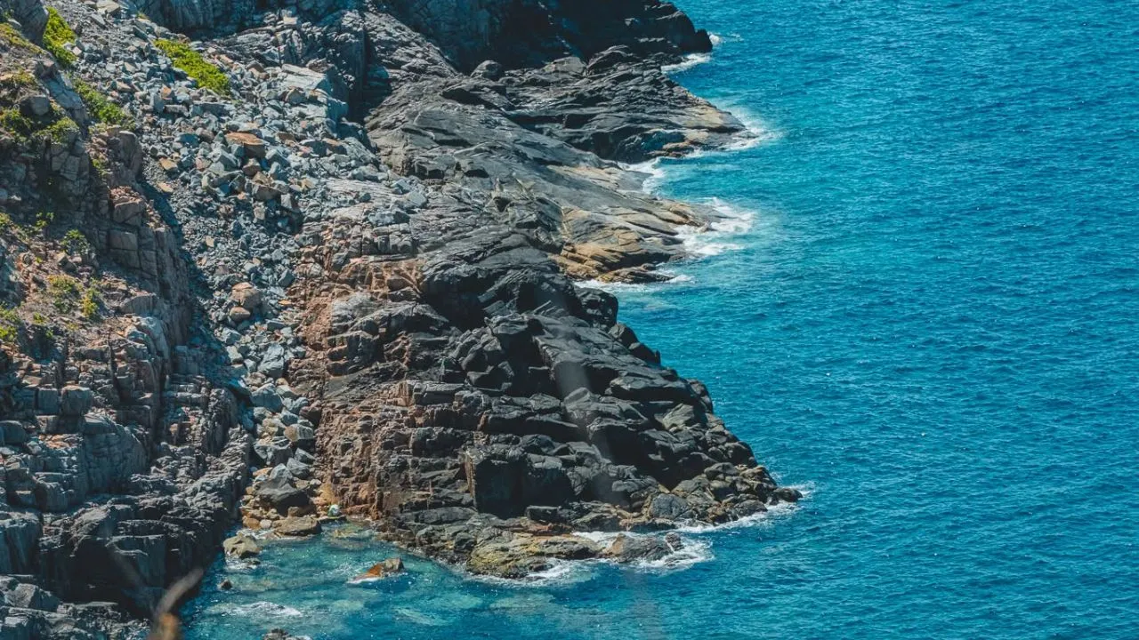
Dam Trau Beach
The beach is about 15 km from the center, located right next to the airport; the sand is fine and smooth, and the water is calm. This is also the place to take photos of airplanes landing at close range. Bus line 173 has a route that goes all the way to the beach.
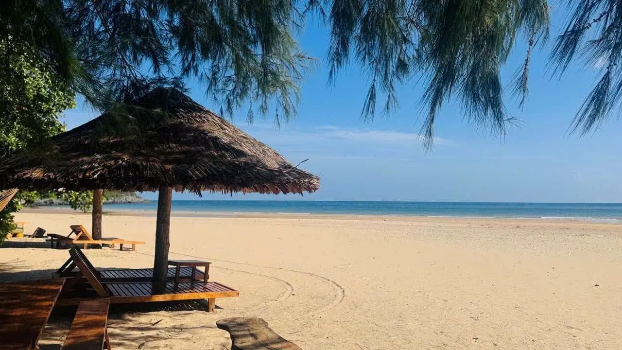
Dam Tre Bay
The bay is located in the north of the island, about 16 km from the headquarters of the National Park, is wind-protected, and is surrounded by mangrove forests. This is a place where the kingfisher nests seasonally and has beautiful coral reefs. It is usually necessary to go by canoe or book a tour with the National Park to enter.
7. Nam Dao Line (direction to Ben Dam Port)
The trail is about 12 km long, so it’s best to go in the afternoon to end with the sunset. If you’re arriving in Côn Đảo by boat, this is the route you’ll pass first.
One Mountain Pagoda (Vân Sơn Temple)
The temple is located on the slope of Mount One, about 1.6 km from the center, and was established in 1964. From the temple grounds, one can see the entire Con Son Bay, the central area, and the An Hai lotus pond.
Shark Nose
The cape is about 6 km from the center along the Ben Dam road, a rocky outcrop reaching out into the sea with vertical cliffs. In the morning, you can watch the sunrise from Hòn Bảy Cạnh. In front of the cape is the cluster of Hòn Tài and Hòn Trác.
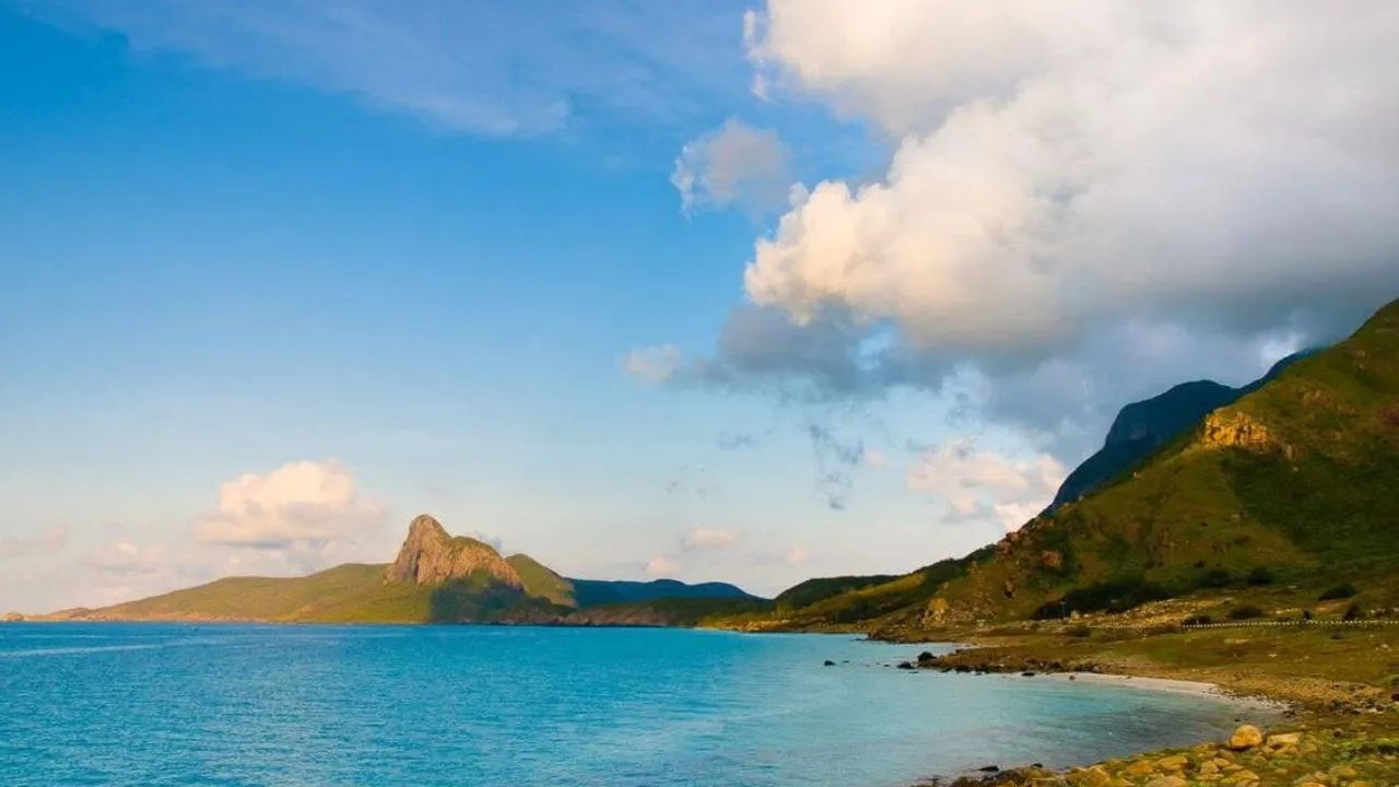
Nhat Beach
The beach is located just after Shark's Bay; it is made of white sand and pebbles that only become visible when the tide recedes. In the afternoon, the sun sets behind Love Peak, covering the entire beach in gold.
The Peak of Love
The two mountain peaks are leaning against each other, looking like a couple of lovers from Bai Nha Beach. This is a familiar symbol in the photo of the Côn Đảo sunset.
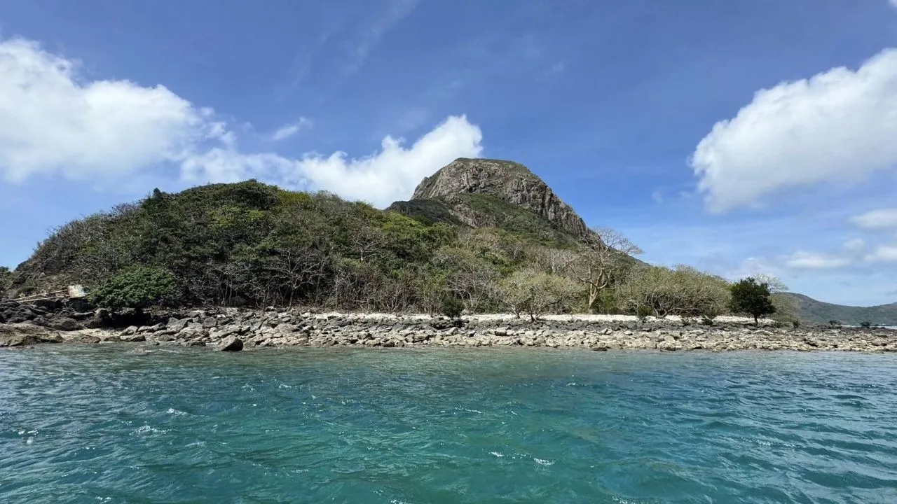
Ben Dam Port
The port is the final stop on the Nam Dao route. In the early morning, visitors can watch the fishing boats dock and buy fresh seafood.
8. National Parks and Small Islands
Côn Đảo National Park covers nearly 20,000 hectares, including both forest and sea. Entrance fee is 60,000 VND per person. Trekking routes start from the west of the center area, while the smaller islands must be accessed by canoe. Canoe rentals are available at the ranger station, as are tour packages or private tours, which cost about 2–5 million VND per session.
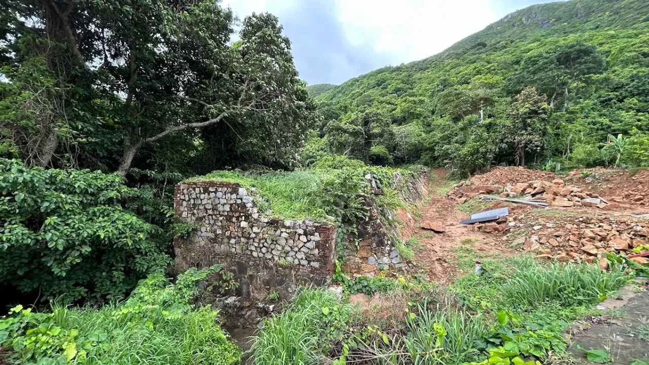
The Bridge of Heavenly Peace
This is an unfinished stone bridge from the French colonial era, located on the western mountain road, associated with many stories of suffering and hardship. Nearby is the entrance to Ong Dong Beach.
Sở Rẫy trekking route
Đường mòn dưới tán rừng nhiệt đới dẫn lên khu Sở Rẫy, có chòi ngắm toàn cảnh khu trung tâm. Trên đường thường gặp khỉ hoang dã. Nên đi buổi sáng và mang đủ nước.
Mr Dong Beach
Từ bìa rừng đi bộ khoảng 20–45 phút qua rừng nguyên sinh là tới bãi đá cuội hoang sơ ở bờ Tây. Bãi hợp để dã ngoại và lặn ngắm san hô gần bờ. Từ đây có thể thuê cano kiểm lâm ra Hòn Tre Lớn và Hòn Tre Nhỏ.
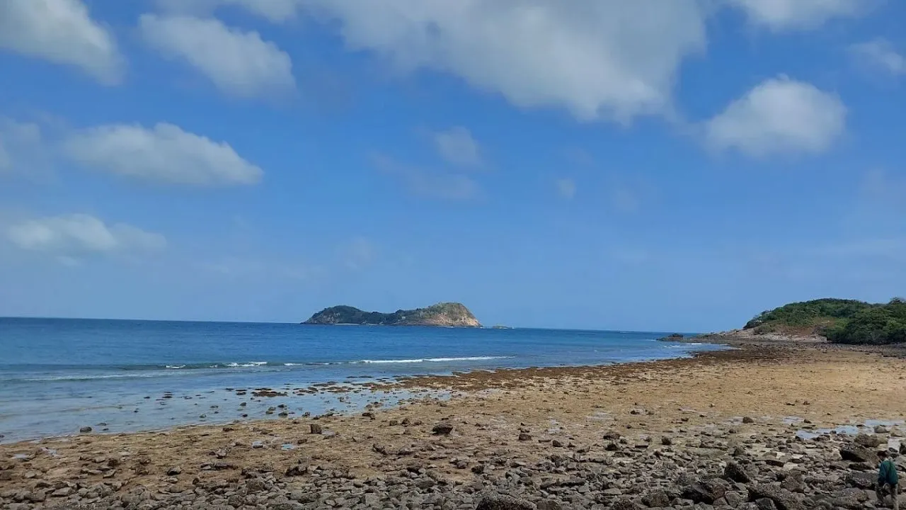
Tuyến Đất Thắm – Bãi Bàng
Tuyến trekking xuyên rừng già ở phía Tây Bắc, đi qua Hang Đức Mẹ. Mùa mưa, suối Bãi Bàng tạo thành các hồ nước ngọt ngay sát biển.
Hon Bay Canh
Đảo nằm ở phía Đông, có mốc đường cơ sở lãnh hải A5. Bãi Cát Lớn trên đảo là nơi rùa biển lên đẻ nhiều nhất Côn Đảo: toàn đặc khu có 16 bãi rùa đẻ, riêng Bảy Cạnh chiếm khoảng 70% số rùa lên làm tổ. Mùa rùa đẻ cao điểm từ tháng 4 đến tháng 9. Du khách có thể đăng ký xem rùa đẻ ban đêm hoặc thả rùa con về biển lúc sáng sớm qua VQG. Tour ghép thả rùa kết hợp lặn san hô có giá từ khoảng 790.000đ/khách.
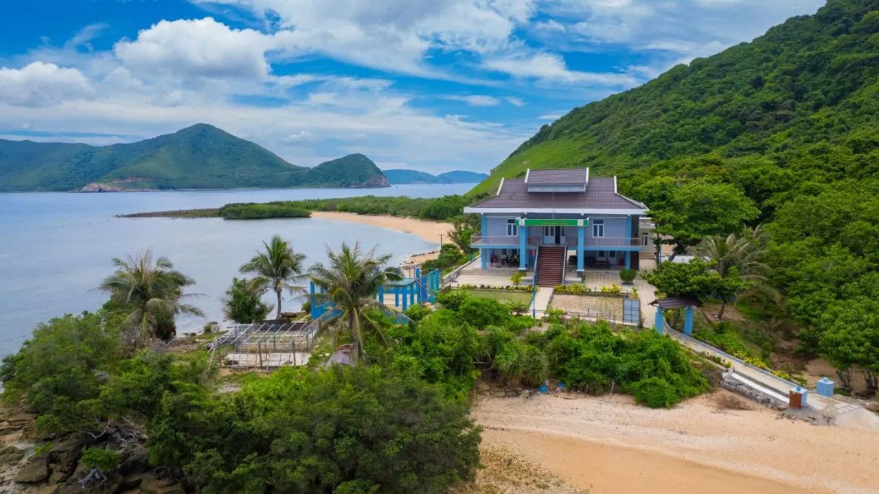
Hon Cau
Đảo cách đảo lớn khoảng 8 km về phía Đông Bắc, có giếng cổ cho nước ngọt quanh năm và rừng dừa. Khoảng năm 1930, nơi đây từng giam một số tù chính trị. Hiện Hòn Cau là điểm lặn ngắm san hô và có bãi rùa đẻ.
Hòn Tài (Lớn và Nhỏ)
Cụm đảo nằm trước Mũi Cá Mập. Vùng nước quanh đây trong, nhiều san hô. Hòn Tài Lớn có mốc đường cơ sở lãnh hải A3.
Hòn Bông Lan
Hòn đảo nhỏ có mốc A4. Cùng với Hòn Tài Lớn và Hòn Bảy Cạnh, đây là một trong 3 mốc lãnh hải dân “săn” mốc thường chinh phục khi đến Côn Đảo.
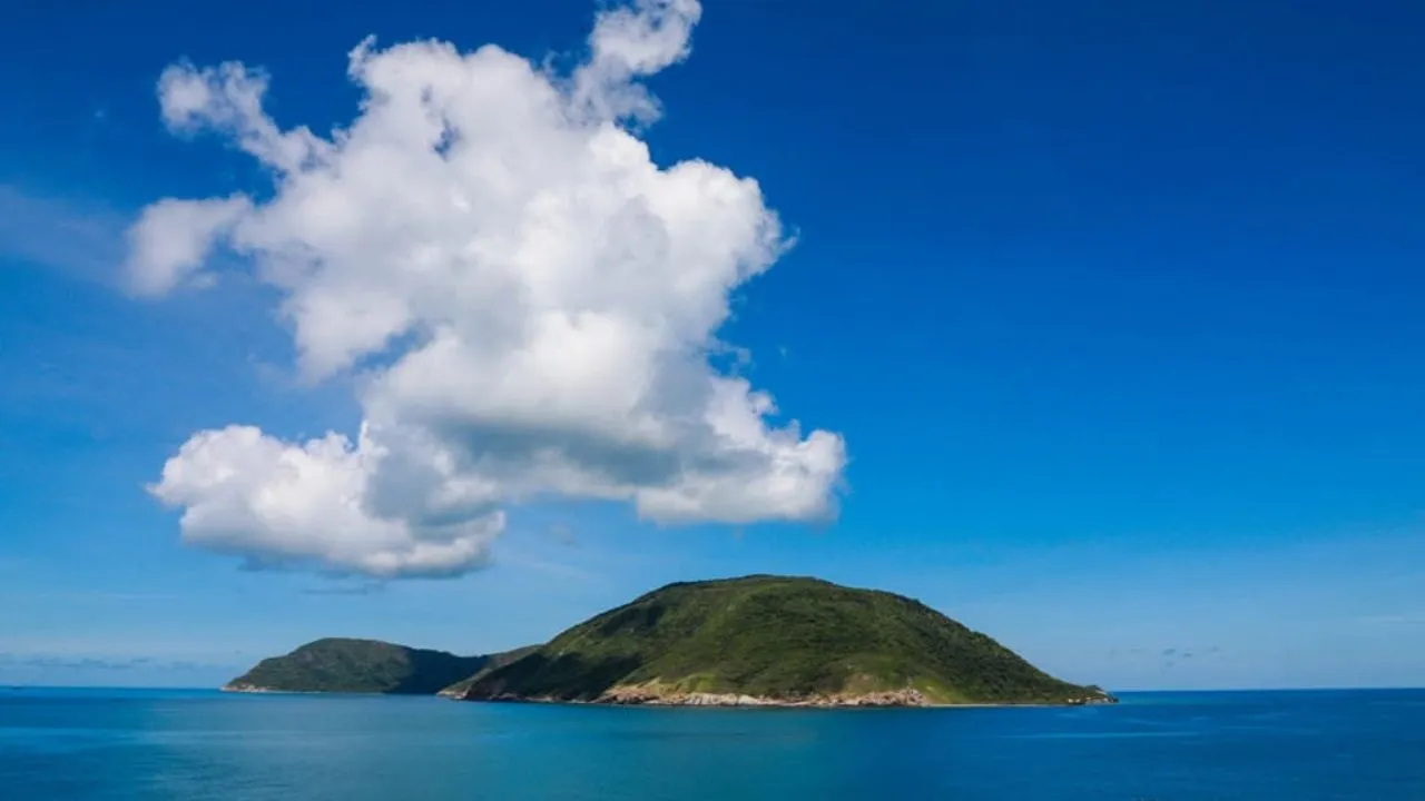
Hòn Tre Lớn và Hòn Tre Nhỏ
Hai đảo nằm ở bờ Tây, gần Ông Đụng. Đây là lựa chọn thay thế để lặn và câu cá khi bờ Đông có sóng. Hòn Tre Lớn có bãi rùa đẻ đông thứ hai, sau bãi Cát Lớn.
Hòn Trứng
Hòn Trứng là sân chim biển có mật độ sinh sản cao nhất Việt Nam, nơi nhàn mào và nhiều loài chim biển về làm tổ theo mùa.
Hòn Bà
Đảo nằm sát cảng Bến Đầm, ngăn với đảo lớn bởi một khe nước hẹp. Hòn Bà gắn với truyền thuyết về bà Phi Yến và còn nhiều rừng nguyên sinh.
9. Bảng tra cứu nhanh khoảng cách và giá vé
| Destination | Cụm | Cách trung tâm | Reference ticket price |
|---|---|---|---|
| Con Dao Museum | Center | ~0,5 km | 20.000đ |
| Dinh Chúa Đảo, Phú Hải, Chuồng cọp Pháp – Mỹ | Center | 0,5–2 km | 40.000đ (4 điểm) / 50.000đ (gồm Bảo tàng) |
| Hang Duong Cemetery | Center | ~1,5 km | Free of charge |
| Phi Yen Temple | Center | ~2 km | Free of charge |
| One Mountain Pagoda | Nam Dao | ~1,6 km | Free of charge |
| Mũi Cá Mập, Bãi Nhát | Nam Dao | ~6–8 km | Free of charge |
| Ben Dam Port | Nam Dao | ~12 km | – |
| Bãi Đầm Trầu, Mũi Tàu Bể | Bắc Đảo | ~10–15 km | Free of charge |
| Sân bay Côn Đảo | Bắc Đảo | ~14 km | – |
| VQG (Ông Đụng, Sở Rẫy) | Sinh thái | Phía Tây | 60.000đ/người |
| Hòn Bảy Cạnh, Hòn Cau | Đảo nhỏ | 5–8 km đường biển | Vé VQG + phí tour, cano |
Giá vé và dịch vụ có thể thay đổi. Nên xác nhận với Ban Quản lý di tích và VQG Côn Đảo trước chuyến đi.
10. Dùng bản đồ để chia lịch trình theo mùa gió
Tháng 3 – tháng 9: ưu tiên bờ Đông và đảo nhỏ
Biển phía Đông êm, đúng mùa rùa đẻ. Buổi sáng nên đi cano ra Hòn Bảy Cạnh, Hòn Cau, Hòn Tài hoặc tắm biển Đầm Trầu. Buổi chiều hay có mưa rào ngắn, phù hợp tham quan các di tích có mái che ở trung tâm. Đây cũng là mùa tàu cao tốc chạy ổn định nhất.
Tháng 10 – tháng 2: chuyển sang bờ Tây và Tây Nam
Gió chướng Đông Bắc làm vịnh Côn Sơn và biển phía Đông động. Lúc này hãy nhìn sang bờ Tây trên bản đồ: Ông Đụng, Hòn Tre, vịnh Bến Đầm vẫn êm nhờ núi che chắn. Đây cũng là thời điểm đẹp để trekking, đi cung Bãi Nhát – Mũi Cá Mập và viếng các di tích. Tàu có thể tạm ngưng khi thời tiết xấu, nên theo dõi thông báo của hãng tàu.
11. Gợi ý lịch trình 3 ngày 2 đêm theo bản đồ
Nếu bạn đến bằng máy bay
- Ngày 1 (Bắc Đảo và Trung tâm): Đáp sân bay, ghé Đầm Trầu, Mũi Tàu Bể trên đường về. Chiều tham quan Bảo tàng, Dinh Chúa Đảo, Phú Hải, Chuồng cọp. Tối viếng Nghĩa trang Hàng Dương.
- Ngày 2 (Đảo nhỏ và Nam Đảo): Sáng đi cano ra Hòn Bảy Cạnh, Hòn Cau (mùa gió chướng thì đổi sang trekking Ông Đụng). Chiều đi Miếu Bà, Chùa Núi Một, Mũi Cá Mập và ngắm hoàng hôn ở Bãi Nhát.
- Ngày 3 (Trung tâm): Dạo đường Tôn Đức Thắng, Cầu tàu 914, mua mứt hạt bàng ở chợ Côn Đảo rồi ra sân bay.
Nếu bạn đến bằng tàu cao tốc
Tàu thường cập bến khoảng cuối buổi sáng, nên lịch trình đảo chiều so với khách đi máy bay:
- Ngày 1 (Nam Đảo và Trung tâm): Lên bờ, đi theo đường Bến Đầm về trung tâm, ghé Mũi Cá Mập, Bãi Nhát, Chùa Núi Một. Chiều tham quan cụm di tích. Tối viếng Hàng Dương.
- Ngày 2 (Đảo nhỏ và Bắc Đảo): Sáng đi cano ra đảo nhỏ. Chiều chạy Bắc Đảo: Lò Vôi, Đất Dốc, Đầm Trầu, ngắm hoàng hôn trên đèo Cỏ Ống.
- Day 3: Sáng sớm ngắm bình minh ở Cầu tàu 914 hoặc Mũi Tàu Bể, sau đó ra bến tàu cho kịp chuyến về buổi trưa.
12. Câu hỏi thường gặp về bản đồ du lịch Côn Đảo
Sân bay và cảng Bến Đầm cách trung tâm Côn Đảo bao xa?
Sân bay Côn Đảo (Cỏ Ống) cách trung tâm khoảng 14 km về phía Đông Bắc, đi mất 20–30 phút; tuyến buýt điện 173 chạy thẳng từ chợ Côn Đảo ra sân bay. Cảng Bến Đầm cách trung tâm khoảng 12 km về phía Tây Nam.
Côn Đảo bây giờ thuộc tỉnh nào?
Từ ngày 1/7/2025, Côn Đảo là đặc khu thuộc TP.HCM. Trước đó, đây là huyện Côn Đảo của tỉnh Bà Rịa – Vũng Tàu.
Tự lái xe máy ở Côn Đảo có dễ lạc không?
Rất khó lạc, vì đảo chỉ có một trục chính nối sân bay, trung tâm và cảng Bến Đầm. Điều cần lưu ý nhất là xăng: cây xăng chỉ có ở trung tâm, nên hãy đổ đầy bình trước khi đi Bắc Đảo hoặc Nam Đảo.
Xem bản đồ 3D Côn Đảo ở đâu?
Truy cập map3d.visithcmc.vn, bản đồ du lịch 3D/360 độ của TP.HCM, rồi chọn khu vực Côn Đảo. Muốn tra cứu phần mộ ở Nghĩa trang Hàng Dương thì dùng nền tảng số của nghĩa trang.
Đi tàu ra Côn Đảo xuất phát từ đâu?
Hiện có tàu cao tốc từ Vũng Tàu (khoảng 3,5–4 giờ) và từ Trần Đề, Cần Thơ (khoảng 2 giờ). Lịch và vé của Phú Quốc Express có tại online.phuquocexpress.com.
Gặp ngày biển động nên đi cụm nào?
Nên chọn bờ Tây và Tây Nam: trekking Ông Đụng, cung Bến Đầm – Bãi Nhát, Chùa Núi Một và cụm di tích trung tâm. Các tour cano ra Hòn Bảy Cạnh, Hòn Cau thường tạm ngưng khi sóng lớn.
Lên đường cùng Phú Quốc Express: Đặt vé tàu cao tốc Vũng Tàu – Côn Đảo, Trần Đề – Côn Đảo nhanh chóng tại online.phuquocexpress.com. Lưu lại bản đồ trong bài để khám phá trọn vẹn đảo ngọc ngay khi lên bờ.
Nguồn tham khảo: UBND đặc khu Côn Đảo; Cổng thông tin Du lịch Côn Đảo (condao.com.vn); Vườn quốc gia Côn Đảo; Thư viện Pháp luật (Nghị quyết 1685/NQ-UBTVQH15); Báo SGGP; VnExpress.
